


Buffaflo Voting District, Shawnee County, Kansas
About
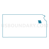
Outline

Summary
| Unique Area Identifier | 587379 |
| Name | Buffaflo Voting District |
| County | Shawnee County |
| State | Kansas |
| Area (square miles) | 37.88 |
| Land Area (square miles) | 37.08 |
| Water Area (square miles) | 0.80 |
| % of Land Area | 97.89 |
| % of Water Area | 2.11 |
| Latitude of the Internal Point | 38.91506630 |
| Longtitude of the Internal Point | -95.87803620 |
Maps


Graphs
Select a template below for downloading or customizing gragh for Buffaflo Voting District, Shawnee County, Kansas


Neighbors
Neighoring Voting District (by Name) Neighboring Voting District on the Map
- City of Auburn Voting District, Shawnee County, KS
- Dover Voting District, Shawnee County, KS
- Harveyville Township Voting District, Wabaunsee County, KS
- Keene Township Voting District, Wabaunsee County, KS
- Meadowlark Voting District, Shawnee County, KS
- North Burlingame Voting District, Osage County, KS
- South Mission Voting District, Shawnee County, KS
- Yucca Voting District, Shawnee County, KS
Top 10 Neighboring County Subdivision (by Population) Neighboring County Subdivision on the Map
- Mission township, Shawnee County, KS (9,365)
- Auburn township, Shawnee County, KS (3,147)
- Burlingame township, Osage County, KS (1,680)
- Dover township, Shawnee County, KS (1,524)
- Plumb township, Wabaunsee County, KS (631)
- Mission Creek township, Wabaunsee County, KS (496)
Top 10 Neighboring Place (by Population) Neighboring Place on the Map
Top 10 Neighboring Unified School District (by Population) Neighboring Unified School District on the Map
- Auburn-Washburn Unified School District 437, KS (34,191)
- Wabaunsee East Unified School District 330, KS (3,186)
Top 10 Neighboring State Legislative District Lower Chamber (by Population) Neighboring State Legislative District Lower Chamber on the Map
- State House District 54, KS (22,524)
- State House District 51, KS (22,133)
- State House District 59, KS (21,469)
Top 10 Neighboring State Legislative District Upper Chamber (by Population) Neighboring State Legislative District Upper Chamber on the Map
- State Senate District 18, KS (67,438)
- State Senate District 20, KS (67,196)
- State Senate District 19, KS (65,414)
Top 10 Neighboring 111th Congressional District (by Population) Neighboring 111th Congressional District on the Map
Top 10 Neighboring Census Tract (by Population) Neighboring Census Tract on the Map
- Census Tract 36.01, Shawnee County, KS (4,670)
- Census Tract 36.04, Shawnee County, KS (3,766)
- Census Tract 102, Osage County, KS (2,893)
- Census Tract 4832, Wabaunsee County, KS (2,544)
Top 10 Neighboring 5-Digit ZIP Code Tabulation Area (by Population) Neighboring 5-Digit ZIP Code Tabulation Area on the Map
- 66610, KS (9,080)
- 66402, KS (2,955)
- 66414, KS (2,914)
- 66413, KS (1,802)
- 66507, KS (1,247)
- 66546, KS (1,012)
- 66431, KS (671)